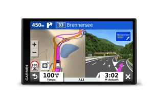
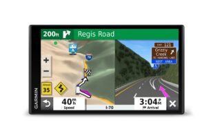
“Please turn around. Please turn. Please turn.” Almost every car traveler knows this phrase and probably has the right voice in their ear. Navigation systems and navigation apps have become an integral part of our everyday driving lives.
While the good old map collects dust in the glove compartment, we prefer to trust modern technology rather than our own map-reading skills. Admittedly, sat navs really are very convenient and easy to use. But despite their numerous useful functions, the many sat nav gadgets on the market also regularly make you break out in a sweat. Namely when, for example, a street is not recognized, a new building is not yet listed or an underpass that is far too low has not been taken into account.
That’s why we often read about embarrassing mishaps due to incorrectly navigated routes. And not infrequently, blind faith in the navigation system was the cause. Unpleasant for those affected, but also a little funny for the rest of the world.
Nevertheless, it is neither necessary nor advisable to do without these helpful navigation systems. After all, with a little brainpower and regular updates to the systems or apps, they simply make finding your way much easier. Motorhome and caravan owners in particular appreciate this, as they have to pay attention to much more while driving than with a normal car.
For example, weight restrictions, height limits or road widths have to be taken into account. Who wants to maneuver through a much too narrow lane with a huge vehicle or be responsible for a traffic jam because you stupidly got stuck in an underpass? A small speedster can get through almost anywhere – but a motorhome? To avoid such situations, there are now numerous navigation systems that have been specially developed for camper vans.
Inhaltsverzeichnis
Portable navigation devices have the advantage that they do not drain the cell phone battery, take up memory space or require constant Internet reception.
Regular system updates bring the devices up to date and their displays are usually easier to use than those of smartphones. Apps or mobile map navigation, on the other hand, boast the latest traffic reports thanks to mobile data reception – and are often cheaper.
One disadvantage, however, is the often poor network on the highways. However, the most important factor when choosing a sat nav is your own requirements. Are you an occasional user, a frequent driver or perhaps part of the smartphone generation?
How large should the map display be? How much will your data volume be used?
These are all questions that – once answered in advance – can of course help you when choosing your navigation system. I have researched various navigation devices, navigation apps and mobile navigation functions specifically for caravans and motorhomes – and present their differences, advantages and disadvantages as well as the financial factors below. “Your route is calculated” – a comparison of portable navigation devices:
TomTom Go Professional 6200
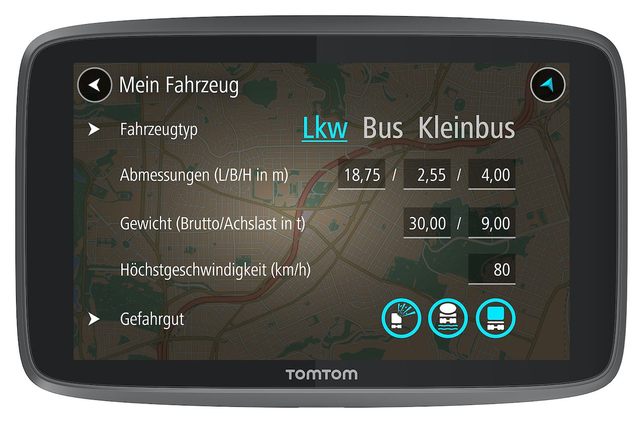
A portable navigation device that was primarily developed for trucks, but also offers useful functions for camper vans and caravans.
Photo: (c) TomTom
Although you have to do without practical camping guides, the TomTom Go Professional 6200 does a good job when it comes to traffic recognition and route guidance. Operation and screen design are clear and uncomplicated.
The manufacturer also promises lifelong map updates via the Wi-Fi function. Bus or truck-specific points of interest such as petrol stations or parking spaces are displayed as well as traffic jam warnings and you can pair the device with your smartphone to have text messages read out to you, for example. It also offers a practical hands-free system.
- Updates über Wi-Fi: Aktualisieren Sie Ihr TomTom GO PROFESSIONAL über Wi-Fi. Kein Computer…
- Spezielle Sonderziele: Finden Sie über 50.000 Tankstellen, Parkplätze, Restaurants und…
Advantages and special features:
- Vehicle settings such as dimensions, maximum speed, weight
- Offline maps for all of Europe incl. Russia
- Clear screen design
- Intuitive controls
- Regular updates via WiFi
- Hands-free and Bluetooth function
Disadvantages:
- No integrated pitch and travel guide
- Sound cannot be transmitted to vehicle loudspeakers
- Low battery power
TomTom GO Camper
The “little sister” of the TomTom Go Professional 6200, with virtually the same functions. But with one difference: the TomTom GO Camper camping navigation device was developed specifically for campers.
Photos: (c) TomTom
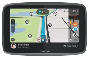
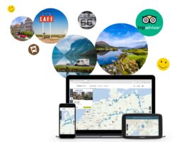
Routes are specially selected for motorhomes and caravans and you can save particularly beautiful routes on your smartphone, tablet or PC and share them with other users on the integrated TomTom Road Trips community platform. Many users have already shared their favorite tours there.
The TomTom MyDrive app adds further practical navigation functions, for example by allowing you to send destinations from your cell phone to your navigation device. Thanks to the cooperation with TripAdvisor, you also receive additional stopover recommendations along the route. Once again, map updates are available for life via WiFi.
- Das TomTom GO Camper Tour-Navigationsgerät bietet spezifische Routen für Wohnmobile, Wohnwagen und…
- POIs speziell für Wohnmobile und Wohnwagen: Ihr TomTom GO Camper Tour-Navigationsgerät umfasst…
Advantages and special features:
- Vehicle settings such as dimensions, maximum speed, weight
- Offline maps cross-continental
- Clear screen design
- Intuitive controls
- Regular updates via WiFi
- Hands-free and Bluetooth function
- Integrated community platform for inspiration and tour exchange
- TripAdvisor recommendations
Disadvantages:
- No cards for Africa
- Sometimes inaccurate with speed limits
Garmin Camper 780 MT-D EU
In addition to the vehicle-specific 3D routes, this navigation device also offers camping and pitch functions, thanks to the cooperation with ACSI, Trailer’s Park or NKC.
Photos: (c) Garmin Deutschland GmbH
Images and prices provide you with information and background information on campsites in the area. The Garmin Drive app also displays traffic and weather in real time. The sat nav also offers integrated Wi-Fi for regular map and software updates. Voice control, hands-free and Bluetooth are also standard, as is compatibility with the wireless Garmin reversing camera.
Sights and POIs from TripAdvisor are displayed in a list view. This is very helpful if you are looking for inspiration and suitable places to go when you are out and about. Of course, you can also enter your exact motorhome or caravan dimensions and weight on this device.
- Haben Sie ihre Route optimal im Blick. Der Camper 780 mt-d EU mit großem, rahmenlosen 6, 95 Zoll…
- Navigieren Sie souverän. Mit Detailkarten von 46 europäischen Ländern, vielen Gebäuden und…
Advantages and special features:
- 2D and 3D display
- Vehicle settings such as dimensions, maximum speed, weight
- Offline maps of all of Europe incl. Russia
- Intuitive controls
- Regular updates via WiFi
- Tips and POIs from TripAdvisor
- Warnings about inclines/gradients, sharp bends, height limits
- Hands-free function
Disadvantages:
- Sometimes slow satellite connection
- Manual suppression of traffic displays such as speed camera messages. speed camera messages
- Frequent information about unknown road permissibility
Garmin Camper 890 MT-D EU
A navigation device with routing that is specifically designed for motorhomes and caravans and comes with pre-installed 3D maps for Europe, up-to-date DAB+ traffic information and a database of campsites.
Integrated voice control makes operation easier, especially while driving. Based on the dimensions of your own vehicle, the best possible route is then selected for you and any dangers or restrictions are pointed out via a real-time service.
You also receive radar, weather and petrol station information when you connect the device to your smartphone via the Garmin Drive app. The high-resolution multi-touch display is quite large at eight inches, but relatively slim at 20 mm deep.
It is also helpful that it works in both portrait and landscape format. If you particularly like a route, you can simply save it and share it with other travelers via the app. If you ever want to travel to countries outside the EU, you can download free maps. By the way: The Garmin Camper 890 MT-D EU is of course also suitable for normal cars.
- Der Empfang von Digital Traffic (DAB) und RDS Traffic Service über das KFZ- Anschlusskabel ist in…
- HOCHAUFLÖSENDES DISPLAY – SCHLANKES DESIGN: Mit einer Größe von 8 Zoll (20, 3 cm) und einer…
Advantages and special features:
- Pre-installed 3D map material of Europe
- Vehicle settings such as dimensions, maximum speed, weight
- Free additional maps of North and South America, Australia and New Zealand, South Africa and the Middle East via download function
- Intuitive controls
- Tips and POIs from TripAdvisor, ACSI, NKC Campercontact, Trailer’s PARK and iOverlander.
- Warnings about inclines/gradients, sharp bends, height limits
- Driver assistance and voice control
Disadvantages:
- Voice control is impaired by external noise
- Sluggish scroll speed
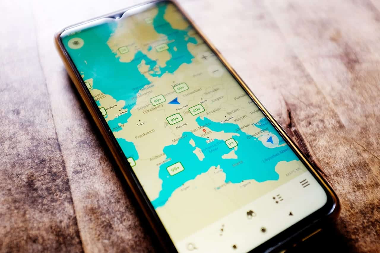
Photo: (c) Nadine Zwingel
Garmin CamperVan
The Garmin CamperVan is a road trip navigation device for vanlifers. The compact routing device with pre-installed 3D European maps, Trendy Places function and large campsite directory is available in 6.95 inch screen format and contains functions for a successful exploration tour.
With the so-called road trip routes function, for example, you receive exciting route suggestions on request for the perfect joyride feeling. You decide how varied you want it to be.
Would you prefer to get to your destination quickly and directly or via adventurous detours with a sightseeing character? Real-time traffic information is controlled via the Garmin Drive app, as well as radar, weather and fuel information. The smart sat nav can also be voice-controlled and can read out messages from your smartphone.
The Garmin CamperVan is particularly suitable for spontaneous travel fans who simply want to drift along instead of planning the trip from A to Z. Simply switch on the sat nav and set off on your adventure.
- Haben Sie ihre Route optimal im Blick. Der Camper 780 mt-d EU mit großem, rahmenlosen 6, 95 Zoll…
- Navigieren Sie souverän. Mit Detailkarten von 46 europäischen Ländern, vielen Gebäuden und…
Pros and special features:
- Pre-installed 3D map material of Europe
- Intuitive controls
- Tips and POIs from TripAdvisor, Michelin, Trendy Places, Roadtrip Route and Local Spots
- Individual adventure routes possible
- Smart controllable
- Live traffic information
- Compatible with rear view cameras from Garmin
Nos and minuses:
- Without individual vehicle settings
- Rather unsuitable for large motorhomes or caravans
GoogleMaps
The classic navigation app and pre-installed on almost every smartphone: GoogleMaps. It now lists over 220 countries and regions as well as numerous companies and places.
If a station is considered particularly interesting, you will receive suggestions for districts and their restaurants, event locations or bars. Otherwise, the app offers information on everything that cell phone owners expect when traveling: arrival time forecasts, current traffic conditions, alternative route suggestions, information on public transport, route planning, offline functions and, of course, classic navigation from A to B.
Users can also add their own photos, recommendations and missing streets. An app that is often used out of laziness, as it is already available on the smartphone, but which also shows the way in an uncomplicated way. It is less suitable for oversized vehicles. GoogleMaps should therefore only be used as an additional aid in normal road traffic.
Advantages and special features:
- Free of charge
- 220 countries and territories
- Offline display
- Easy operation
- Display of gas stations, parking lots and points of interest
- Various navigation filters
Disadvantages:
- Can be used more as a supplement
- Not reliable for larger vehicles
ViaMichelin
Navigation, radar control, route plan. That’s what the free ViaMichelin app from the provider of the same name, Michelin, offers subscription-free. The greatly simplified display makes it easy to find your way.
If you prefer a more detailed view, you can switch to the satellite or aerial view. The app calculates routes that can be covered on foot, by motorcycle, bicycle or car, taking into account both the time and the current traffic situation.
In addition, you are informed of danger messages, speed limits and costs such as tolls. Worldwide maps and city maps guide you safely from A to B. An additional setting option for caravans and motorhomes is also designed to navigate larger vehicles safely through road conditions.
However, it is not 100 percent reliable, according to one or two user reviews. Nevertheless, ViaMichelin offers a practical alternative to GoogleMaps and provides additional support when driving through the urban jungle, highway intersections and the like.
Advantages and special features:
- Free of charge
- Maps worldwide
- Offline display
- Easy operation
- Display of gas stations, parking lots and points of interest
- Various navigation filters
- Without advertising
Disadvantages:
- Can be used more as a supplement
- Individual vehicle settings only work to a limited extent
- Without lane assist
Sygig Truck GPS
Sygig Truck GPS is a navigation app for large vehicles and with special route guidance for trucks, buses or camper vans and caravans.
The app is free for the first 7 days, after that there is an annual subscription.
The lifetime license for Europe Camper, for example, costs 69.99 euros, while Europe Truck is available for 99.99 euros. You can add additional functions, such as Live Services Europe, with an in-app purchase.
Maps are saved offline on your cell phone, which saves your mobile data consumption. Only the GPS signal should work, of course.
When you purchase the navigation app, you also get access to free updates for maps, POIs and speed cameras for three years. You can also enter vehicle-specific features such as height, weight, length and axle in the settings. Practical: By entering a data volume limit, there are no nasty surprises afterwards.
Advantages and special features:
- Only loads the cards you really need
- Always up-to-date speed limits and speed camera reports
- Avoidance of fines through possible add-ons
- Display of current gasoline prices
- Configuration with vehicle data
- Camping and parking lots as POIs
- Rest areas and petrol stations as POIs
- Offline display
Disadvantages:
- Access to free updates for three years only
- Maximum speed is always automatically limited to 100 km/h
- Consumes cell phone memory
CoPilot GPS
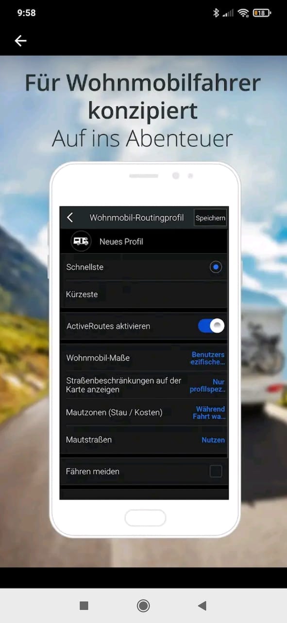
CoPilot GPS is a paid app for all vehicle types. Classic services such as voice navigation, route planning and traffic information help you choose your route. It provides information about low bridges or roads that are not permitted for heavy vans. An extended function also provides you with suitable motorhome navigation. Pre-installed points of interest such as campsites or rest stops are also displayed. The map material can also be accessed offline by downloading it in advance, saving you data volume. All in all, a practical app that will definitely get you reliably from A to B. CoPilot GPS is free for the first 14 days, after which you can choose a time-limited subscriptionfor cars, trucks or motorhomes. The worldwide map material costs an additional 29.99 euros.
Advantages and special features:
- Worldwide map material
- Offline display
- Vehicle-relevant data input possible
- Display of campsites and rest areas
- Lane assistant
Disadvantages:
- Paid and time-limited subscription
- Real-time traffic information only possible with mobile data function
Maps.Me
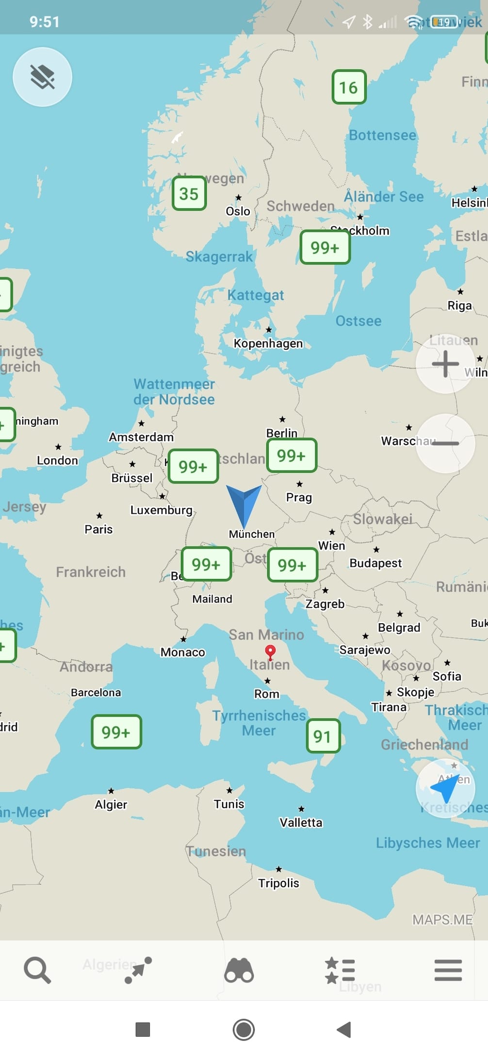
The Maps.Me app is free – until death do you part, including free offline maps. Goodbye lame internet connections! Information about parking lots, ATMs, etc. as well as an integrated travel guide provide information about all kinds of sights and destinations. The app is not only suitable for vehicles, but also for hiking or cycling tours. The drawback: Maps.Me was not developed specifically for motorhomes, caravans or larger vehicles, but rather serves the classic car market. Nevertheless, the app can be helpful as a supplement to a cell phone if, for example, the portable navigation device goes on strike. The maps on Maps.Me are updated daily by users. It is a kind of open source alternative to the classic GoogleMaps. It is also available worldwide. So if you don’t mind advertising and want to have an additional orientation aid at hand, this app is recommended.
Advantages and special features:
- Free of charge
- Maps worldwide
- Offline display
- Helpful information and recommendations from other users
- Integrated travel guide
Disadvantages:
- No entry of vehicle-relevant data possible
- Integrated advertising, unless you pay for the premium version
- Can be used more as a supplement
Waze
Waze is a simple app which, in addition to navigation and route planning, displays common standard applications such as traffic reports, traffic jam warnings and estimated arrival times. To ensure that your fuel stop ends as cheaply as possible, you can also display the petrol station with the lowest fuel prices in your area. The voice control, which can be set individually, is particularly humorous. For example, it is possible to have a boy band “sing” directions to you. However, many of the integrated app voices are in English. Very brave ears can use their own voice. This can also be set in Waze. However, if you rely purely on voice instructions, you may get into trouble here and there. Because sometimes the “turn right” sounds a little too late for a safe lane change maneuver. Various additional functions, such as the Waze Carpool passenger search, make the app appealing for travelers who want to reduce fuel costs.
Advantages and special features:
- Free of charge
- Real-time map
- Easy operation
- Coupling function to preferred music app
- Display of gas stations, parking lots and points of interest
- Various navigation filters
Disadvantages:
- Can be used more as a supplement
- Road data is only edited by users
- Mobile Internet required
As a technophile with an old-school attitude, I actually belong to the dying breed of paper map readers. Admittedly, I still sometimes use GoogleMaps. However, since I own a nimble little minivan, difficult maneuvers, weight restrictions or suitable parking space sizes are not factors that have caused me any difficulties so far. During my research, I realized one thing above all else: have more respect for truckers, big-ship captains and caravan drivers! Thanks to all the information, I now know a lot more about their challenges and problems in relation to different road conditions. Whether navigation devices or apps – both are helpful tools for arriving safely in the end. It’s no secret that concentration, thinking and sometimes even a dusty old map are still required. That’s why I particularly appreciate offline map functions, as they promise more reliability and use less data. Whether on the navigation device or on the cell phone doesn’t really matter to me. The main thing is that it is functional and takes into account all relevant, vehicle-specific features. You might just find a suitable bargain in our camping offers. Take a look straight away! In the end, the best you can say is: “You’ve reached your destination.” Congratulations!
Nele and Sebastian also discussed navigation and route planning in our podcast. All information and tips in conversation: Have a listen:[su_spacer size=”10″]
[su_spacer size=”10″] [su_box title=”Das könnte dich auch interessieren”]
- Podcast: Navigation and route planning
- Through Europe with the Corona-Warn-App
- Testing the ADAC camping and pitch guide app
- Vacations without a ticket: the most important traffic rules in Europe
- Internet on the move – online throughout Europe with CAMPERNET
- E-readers: reading with comfort
[/su_box]
Letzte Aktualisierung der Preise am 2026-01-08 / Affiliate Links / Bilder von der Amazon Product Advertising API
